And so the mammoth 2011 trip finished in a suitably majestic corner of the world, where the colour green rules and imperious snow laden volcanoes remind you that this Starbucks caramel macchiato could be your first and last. It also brings to an end some mammoth blog entries, and the challenge of condensing 72 days and 3,239 photos into a few trite words and pretty pictures. That’s an average of 45 photos a day, which is pretty ridiculous but such is the modern age of mega memory cards and my haphazard digital shooting. For the record, and to prove to myself that I still have the old magic, New York unsurprisingly had the largest average photo quota of 153 spd (snaps per day), while Spain the lowest (a measly 5.4 spd...too many siestas and holiday waters methinks). The most photos in total however were from the Pacific Northwest, just topping out at over a thousand and an average of 62.8 spd in the 17 days spent there.
 This particular photofest commenced on a flight up from Los Angeles, which itself looks best from the air, over the wonderful Californian Sierras and Yosemite, north across the vivid blue of Tahoe and ever onward until the characteristic murk and moisture of the northwest jetstream shrouds Seattle. A jetstream that was to frustrate in my pursuit of perfect blue skies and alpine meadows and glimmering mountain tops in the next 17 days. Still, it didn’t stop me taking that many photos did it?!
Oop north
Reaching this corner of the world was quite a trip in itself – a cross-country flight from New York, up to Seattle and then onward in a waiting-to-be-splattered-by-mud-and-flies white Toyota Prius to the town of Bellingham, only a relative stone’s throw from the Canadian border. The next day, the contrast from New York was all too apparent, deer crossing the suburban roads on my way to a little stroll through the town’s Whatcom Park and its pretty falls. I liked Bellingham pretty much immediately.


 From here my mission was to hopefully capture sight of the first big volcanic mound of the trip, Mount Baker. It wasn’t to be (today at least) but the ride along Highway 542 was a good way to open up my journeying into Cascade country. The pounding mountain waters plummeting at Nooksack Falls were a particularly rewarding stop, before climbing up to the terminus of the road around Mirror Lake.
Here came the first of many mountain sighting taunts, some of which I won, but more of which I lost to superior elements. The question is, how much patience do you devote in a seemingly futile hope that clouds will clear and views will glow?  One guy who I met along the short lakeside circuit indicated he had been waiting all day for a peek at reflected Mount Shuksan, which is supposedly one of the most photographed shots in all of America (seems there were quite a few of these most photographed places in the region!). I spent a less devoted half an hour and then a return visit an hour or so later, where there was at least some reward without getting the money shot.
 One guy who I met along the short lakeside circuit indicated he had been waiting all day for a peek at reflected Mount Shuksan, which is supposedly one of the most photographed shots in all of America (seems there were quite a few of these most photographed places in the region!). I spent a less devoted half an hour and then a return visit an hour or so later, where there was at least some reward without getting the money shot.
The following day – as it so often seemed to do after a day trying to sight big mountains – was clear as a crystal and Mount Baker was hard to avoid from all around. I was back down at sea level, embarking on a ferry ride to the San Juan Islands, and its largest  lump, Orcas Island. There is of course something very appealing about island life, and Orcas Island presented a great deal of pleasing diversity in its own square miles. There was pastoral wholesomeness juxtaposed with rugged forest and mountain lakes, placid bays and calm coves sheltering from isolated cliffs and frigid seas, and fine foods and fresh produce shining out from a world of processed twinkies and cardboard burgers. The pinnacle of all of this? Well, Mount Constitution, which is conveniently – albeit somewhat twistily – driveable and, on such sparkling days, offers a panorama across all of Washington and coastal Canadiana. Mount Baker abounds, but so too in the distance does Rainier and Adams, the Olympics jut up, and the waters of Puget Sound swallow up whole islets and lap into bays and crevices in every angle.

 lump, Orcas Island. There is of course something very appealing about island life, and Orcas Island presented a great deal of pleasing diversity in its own square miles. There was pastoral wholesomeness juxtaposed with rugged forest and mountain lakes, placid bays and calm coves sheltering from isolated cliffs and frigid seas, and fine foods and fresh produce shining out from a world of processed twinkies and cardboard burgers. The pinnacle of all of this? Well, Mount Constitution, which is conveniently – albeit somewhat twistily – driveable and, on such sparkling days, offers a panorama across all of Washington and coastal Canadiana. Mount Baker abounds, but so too in the distance does Rainier and Adams, the Olympics jut up, and the waters of Puget Sound swallow up whole islets and lap into bays and crevices in every angle.
From such heights it was down to the water for my accommodation for a couple of nights, but this was no major comedown. I think what was so great about Doe Bay was that you were quite content to not do anything other than just hang out there – on a bench, on the grass by the water, in the excellent cafe, or looking out over the cove from your own yurt – a round dome of a tent that was home. Ideal for a nanna nap in the arvos and a read by the water, suitable for a forage on the beach or potter about in the woods and, with such perfect weather, what more could you ask for? A definite highlight and perfect place to wake up on my birthday and be treated to a breakfast burrito.


Despite this constant lure there was some motivation to explore elsewhere; not least Moran State Park in which Mount Constitution sits along with acres of pine forest and mountain lakes, all very accessible for a good hike and picnic lunch.  Elsewhere, the main settlement of Eastsound provided more calming bays and very good eateries, the Mexican flavour of my birthday breakfast preceded by Mexican dinner and not just any old dirty taco and fajita joint, let me tell you.
 Elsewhere, the main settlement of Eastsound provided more calming bays and very good eateries, the Mexican flavour of my birthday breakfast preceded by Mexican dinner and not just any old dirty taco and fajita joint, let me tell you.
Such fuelita was welcome on the trip back across the water to the mainland, propelling me to Anacortes and the very picturesque bridge across Deception Pass, before journeying south towards Seattle and its satellite towns and burgeoning suburbs. Here, as strip malls interfered with a pleasant drive, there were again brief glimpses into the Cascades, and, with them, future paths to be taken.


Blasted rain
It was with a little tiredness and emotionality that I awoke the day after my birthday in a very comfortable, homely bed in Sammamish. When you are travelling from motel to yurt, munching between Maccers and Fred Myer, nothing can be more wondrously comforting than home comforts and sincere thanks to Jon and Jane and Anja and Amelie and Mo for regular pitstops and rejuvenation breaks during my visit. But time, and tiredness and emotionality, waits for no man and it wasn’t too long before I dusted myself down once more and hit the road with the intention of heading in a generally southerly direction towards Oregon and then back again. A sort of circular road trip with lots of straight lines, wiggly curves and zig-zags.
 First east a little, albeit at a slightly southerly slant, and just half an hour for the first stop at Snoqualmie Falls, whose torrent of water seemed to be generating all the misty drizzle around here. There’s a hotel up at the top which was the setting for Twin Peaks – not the first and certainly not the last kind of weird quirky show or movie to be set around this part of the world. Then it was truly off in a much more definite southerly direction on some quiet country back roads. Well, they looked like quiet country back roads on the primeval map I obtained but in fact turned out to be littered with traffic lights and crossroads and superstore after furniture shop after donut kiosk. The kind of place where you need one of those big wheeled black pick-ups it seems, just so you can tackle the drive through bank at just the right height.
Mercifully things picked up a little and the weather even threw in some ‘sunbreaks’ along a nice quiet straight southerly road to the small town of Morton, which I decided was to be my stop for the night. However, there was still quite a bit of day left, and Mount St Helens was just around the corner. I say round the corner but it was a fair drive, the conversion from Australian kilometres to more demanding US miles proving a bit of a struggle. After driving for about ten days through a twisty, bumpy stretch of tar which battled its way through shadowy forests, the slightly less white Prius emerged into the barren blast zone from the 1980 eruption.  It was quite something really, and well worth the drive, as I ended up at the appealingly named Windy Ridge. Not so windy (no recent Mexican refried beans for me), but a steep little walk to look out on the empty volcanic landscape and across Spirit Lake.
 It was quite something really, and well worth the drive, as I ended up at the appealingly named Windy Ridge. Not so windy (no recent Mexican refried beans for me), but a steep little walk to look out on the empty volcanic landscape and across Spirit Lake.
Spirit Lake is possible best known for Harry Truman, one of those old codgers who gains infamy by refusing to leave his home despite impending and inevitable doom and repeated warnings of such. More interesting to a former top of year Geography student is how the blast changed this lake by blocking its outlet, raising it 200 feet in altitude and making it smaller and shallower. Other lakes were formed from scratch, such as Coldwater Lake, which I visited the next day on the western access road up to Johnston Ridge Observatory.
Up at Johnston Ridge itself, further geography memories resurfaced like pyroclastic flow emanating from a lateral blast, thanks to many colourful models and informative theatre presentations. The really clever thing about the short film though was how it started while a shroud of damp cloud encircled the observatory and ended, curtains winding back as the movie screen lifted, to reveal Mount St Helens itself, the clouds now giving a false illusion of steam and smoke (if you squint a bit). In the Pacific Northwest, I believe this categorically counts as a mountain sighting.  As mountains go it’s a bit disappointing...no snow capped crevices, spiky forests and flowering meadows. But then what do you expect when it decided to explode off its north face across southwest Washington and shrunk 1,300 feet in the process? Fascinating.
 As mountains go it’s a bit disappointing...no snow capped crevices, spiky forests and flowering meadows. But then what do you expect when it decided to explode off its north face across southwest Washington and shrunk 1,300 feet in the process? Fascinating.
Less fascinating is the I-5, but it’s pretty useful, especially when they let you actually travel at a reasonable speed limit. In what seemed like no time I was crossing the Columbia River and entering Oregon where, immediately, Portland hits. For some reason, there are a lot of bridges in Portland and I crossed one, missed my turn, looped back over another and tried to park near the place I was staying. I stayed here and struggled with parking a whole three nights, probably a night too many, but while Portland can definitely be described as one of those places it is better to live in than visit, it provided a good base from which to get a sample of northern Oregon.

I liked Portland a lot the first night I was there, wandering randomly as I did into Powell’s bookstore, losing my way in its voluptuous labyrinth of humungous aisles, flicking through books with an excellent coffee, and buying two for a tenth of the price they would cost in Australia. The next morning started off on the same footing with more good for America coffee and an almond croissant no doubt made with a whole block of butter. It fell by the way a bit from there, the gloomy skies not helping as I struggled to find anything resembling an ‘attraction’ for aimless tourists like me, nor a true big city style buzz. The thing I don’t quite understand about Portland is how it is continually described as a success in urban planning, management, liveability etc etc yet there are so many homeless people here, there and everywhere. Is it so good, even the homeless flock here? And in true US eat-my-shorts fashion, even Portland can’t offer much in the way of help or welfare, despite being the very model of urbanity?
Such places – and I should know having lived in Canberra for five years – tend to get by with attractions like rose gardens and coffee shops and, more often than not, events like balloon fiestas and multicultural festivals. So I took in the rose gardens and the nearby Japanese Garden and very pleasant they were too, especially as there were a few more afternoon ‘sunbreaks’ to enjoy them in. But I was almost relieved to be heading out of town for the day the next day.


It was a big day, an early start for a circular trip around Mount Hood – Oregon’s largest peak and another of those pesky Cascadian volcanoes – and back via the Columbia River Gorge. Would this particular mountain be out? It didn’t look too promising but at least the overnight rain had ceased as I made my way east, past a place called Boring, in which I did not feel encouraged to stop. Instead, my first stop was beside the highway and a trailhead up to a small patch of water called Mirror Lake, which reflected all the cloud perfectly.  Again, it was a question of how long to wait to see if anything changes, standing there on my own, helpless prey to a hungry bear? I gave it ten minutes and got pretty lucky this time, as the white cover of Mount Hood battled to distinguish itself from the white cloud and emerged true and strong. And the bear thankfully opted for someone else’s picanic basket.
 Again, it was a question of how long to wait to see if anything changes, standing there on my own, helpless prey to a hungry bear? I gave it ten minutes and got pretty lucky this time, as the white cover of Mount Hood battled to distinguish itself from the white cloud and emerged true and strong. And the bear thankfully opted for someone else’s picanic basket.
Down the trail, across the road and up and round a bit from here stands Timberline Lodge, a wooden palace of a lodge full of roaring log fires and moose heads and stuff.  The exterior provided scenes for The Shining, though I don’t remember the cranes and building site which were about, ruining most photo attempts. Today it seemed a bleak spot in which to be working, as the snow line had descended, it was cold and overcast and those log fires were doing overtime.
 The exterior provided scenes for The Shining, though I don’t remember the cranes and building site which were about, ruining most photo attempts. Today it seemed a bleak spot in which to be working, as the snow line had descended, it was cold and overcast and those log fires were doing overtime.
Given all work and no play makes Jack a dull boy I descended and headed on, around the east side of the mountain and through a rather picturesque and much sunnier valley where Jack Nicholson would look a lot less scary. Here were the first real fall colours of the trip on display, dotted on steep banks in between rigid pines, flowing along the ribbon of road headed north to the great natural barrier that is the Columbia River.
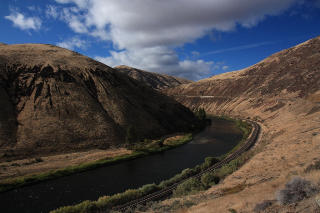
The Columbia River cuts a huge chunk out of the mighty Cascade Range, providing a deep shipping channel and transit point for early intrepid explorers like Lewis and Clark and Ray Mears. Nowadays you can follow it by road, and what a beauty it is heading back to Portland...sweeping fast curves with river views, hemmed in by precipitous cliff lines that have been carved out by the power of water, and a reasonably generous speed limit.


 The water continues to power down and shape this landscape, with a series of grand falls plummeting their way into the Columbia Gorge along the way. The most popular, and quite rightly so, is Multnomah Falls, a beauty of a double decker flume, with the most aesthetically pleasing arch bridge to allow bears to cross and come and eat you, or steal your camera. I would have been safe though, since I had by now developed a strategy for scaring off hungry bears. It mainly involved rattling change in my pocket and / or singing and whistling to myself like a deranged animal. Ultimately I had a 100% success rate, because I never got to see any bears , and even scared off a few humans.
 There were something like five other waterfalls in close proximity to Multnomah, but with limited daylight left for my visit I plumped for a stop at Bridal Veil Falls. Yet another original and inventive name which quite nicely resembled – let me think about this – a wedding dress veil? It was a very serene spot – well, apart from the crashing of thousands of gallons of water – and the rain returned to blanket the shady woodland around and maximise use of my new waterproof. A reminder, often a constant reminder, that such beauty requires something really really annoying to be so beautiful.
Rainer and rainier, with some brighter interludes
The next day took me away from Portland and heading west towards the coast, with a plan to pivot north, re-enter Washington and gradually swing my way towards its highest point, Mount Rainier. The ride to the coast reminded me a little of an Aussie coast trip, climbing up and over thick forests, following waterways down to the point where they meet the Pacific Ocean.  The town of Seaside was the Batemans Bay of this particular simile, but just a little down the road was Cannon Beach, where broad sweeping sands were perforated by giant clumps of rock and driftwood. Ideal for dog walks and wistful gazes out to sea, though these activities somewhat challenging in the freezing cold wind buffeting the shore. Nevertheless, it is always nice to be beside the seaside.

 The town of Seaside was the Batemans Bay of this particular simile, but just a little down the road was Cannon Beach, where broad sweeping sands were perforated by giant clumps of rock and driftwood. Ideal for dog walks and wistful gazes out to sea, though these activities somewhat challenging in the freezing cold wind buffeting the shore. Nevertheless, it is always nice to be beside the seaside.
I followed the coast road south for a small stretch and was feeling in good road trip territory, as scenic viewpoint after scenic viewpoint emerged around every turn. This may, or may not, carry on all the way into California. For my part I stopped at Manzanita, which seems to be one of those places where you can pop in for a coffee and end up spending the rest of your life there because it is so darn nice.  This was incalculably aided by the best sandwich I have eaten for a long time – it was all about the moment and the fact that I was very hungry and feeling a little lethargic. But thank you Bread and Ocean (http://breadandocean.com), which deserves a plug to my five readers who are very unlikely to be in small town in windswept coastal Oregon anytime soon.
 This was incalculably aided by the best sandwich I have eaten for a long time – it was all about the moment and the fact that I was very hungry and feeling a little lethargic. But thank you Bread and Ocean (http://breadandocean.com), which deserves a plug to my five readers who are very unlikely to be in small town in windswept coastal Oregon anytime soon.
The remainder of the day didn’t really peak beyond that panini, as it mostly involved clocking up the miles, the coast vanishing behind strip malls at Astoria and turning once more into the wide Columbia River as I vaguely followed this east. By time I decided to call it quits, I was almost running over a herd of elk outside the small town of Packwood, where a $30 motel room was surprisingly homely and comforting and provided shelter from the ever increasing rain...
...which I was hoping would stop, given we were now on Thursday which was forecast to be the driest day of the week. Maybe they misspelled and meant direst day of the week? Or maybe, I should not be so stupid and assume dry and sunny in Seattle means the same around Mount Rainier, which, as they frequently say, is so big it creates its own weather. Alas, for some reason, most of the weather it creates involves water moisture and vapour and ice, mixed perhaps with a little drizzle. This meant that Nisqually Vista was more like Squally Novista and Paradise was more like, well, Perisher. Early snows had fallen and, despite an obvious hidden beauty shrouded by this weather, there were to be no views of wildflower meadows and a giant white peak seemingly promised to me by the cover of my Lonely Planet guide.


Despite milling around at the visitor centre for a while, taking in a few precarious icy fogwalks, and eating a picnic bagel in the car, nothing cleared, there were to be no snatched views of the mountain. In fact it got a lot worse before the Prius descended like a golf cart through a freezing drizzle to a more comfortable altitude. At least here, things were more amenable and a short jaunt along the Grove of the Patriarchs provided some welcome colour and presented a certain grandeur through the ancient forest.


Still, I did have two days bash at Mount Rainier and awoke on Friday to the joyful sound of incessant rain drumming on wooden verandas and an outlook about as appealing as a front row seat at a Nickelback concert (who were inexplicably on the radio a lot and inexplicably more still around). Perhaps it would be better, at least there would be something, on the eastern side? Didn’t look too good as I parked up at what sounded like a rather wonderful walk around Tipsoo Lake and Naches Peak. There was simply no point whatsoever to freeze my butt off and struggle to see five metres in front of me, even if it meant getting away from Nickelback on the car radio.
I toyed with heading back to Seattle early, or going east to Yakima purely for some sunshine and warmth. One last throw of the dice before I get that desperate – the road to Sunrise in the northeast was closed because of snow, but how far up it could I go? As it turns out, as far as White River, which was flowing white, bubbling across pebbles and rocky debris and tree trunks as it fed its way down from Emmons Glacier. Whiter however was a rather large hill lurking round the corner and it was with some jubilance that I got to see that the mountain was out.


 Leading up to this point I was feeling very annoyed and a ‘bad-luck-always-happens-to-me-mopey-whiney’ kind of mood, swearing at the rain with a ferocity worthy of Gordon f**king Ramsay. But not only was the mountain out, but the weather here was f**king tremendously idyllic, so much so that I could and very much did take my waterproof off. A walk through the woods in the general direction of a big f**k off glacier presented a series of crystal cascades flowing down hillsides and glistening as the sun filtered its way through the gaps in freshly scented toilet cleaner pine forest. There were rivers to cross on rugged wooden bridges, rocks to climb, bears to hopefully not bump into, mountain views and glacial lakes and cluttered moraine. Alas no wildflower meadows here, but considering just how utterly miserably lousy it was, f**k me it was f**king awesome.


I think equally as pleasing, in a roundabout kind of way, was that I passed once more the parking lot (as they call it) at Tipsoo Lake where I had been earlier in the day with the lads from Nickelback. It was still as miserable as sin and you would never have thought there was a hope in hell of enjoying a sunny walk with Washington’s highest peak alongside for company. Such is the genuine wondrousness of rainshadow and another Geography lesson experienced. This enjoyment of rainshadow – not just from Rainier but the whole Cascade range –
 was further embraced with a descent from the east, down and down and down a beautiful river valley reminiscent of the California gold hills and into a parched Nevada of a landscape around Yakima. In little more than an hour, freezing snow was dry and dusty shorts weather, and a thickshake was the refreshment de jour, rather than hot chocolate.
Time for some Seattle prattle
 The next day and Rainier appeared to be well and truly out from all sides, keeping up with the tradition of being gorgeous the day after I leave, given I could glimpse it from some 75 miles or so back in Sammamish. In fact, Saturday turned out to be a rather splendid fall day, when lakeside walks and glorious Baconmaster burgers were capped off by pumpkin carving and beers in the neighbourhood. As ludicrous as it may sound, the pumpkin carving stands out as a highlight of my trip. I think in part this is because it encapsulated that neighbourly and family warmth that you so often crave when travelling alone for periods of time, along with a quirkiness that you often end up remembering more than yet another mountain or yet another bay. Plus my pear-shaped pumpkin was rather awesome and I grew very attached to him by the end of it.

 While partial gloom returned on Sunday, the waterproof remained packed away for a trip into some offbeat Seattle sights with Jane and the kids. Most of this was centred around Fremont, a suburb to the north of the city with a slightly grungy post-industrial hipster air and some fabulous waterside views. There was, for instance, the very random Fremont Bridge troll, which sits under one of the many hard to find bridges and provides a beacon with drunks and hoboes everywhere. There were also some locks and a salmon ladder where, inexplicably, there were no salmon to be seen. I did see some later through,
  both heading towards my mouth at Ivar’s Salmon House and also failing to jump the weirs back in suburban Issaquah.
Later in the week, on another sunny non-mountain day, I headed into downtown Seattle itself, taking the fast and efficient park and ride. It was a rather pleasant day to wander around the city which is no New York but has a few more sights than Portland. There is of course the Space Needle, along with a cluster of other shiny and wobbly buildings and sculptures, looking resplendent among gardens and sunny autumn colours.  From this literal point I walked along the water’s edge, past numerous piers hosting ferries and boats intent on leaving Seattle for places like British Columbia and Alaska. Eventually this brought me down alongside Pike Place Market, which was in full lunchtime bustle and very enjoyable too. I mean, not only was the giant hotdog followed by chocolate dipped cheesecake, but there was plenty of entertainment and people watching / camera-stalking opportunities.


 From this literal point I walked along the water’s edge, past numerous piers hosting ferries and boats intent on leaving Seattle for places like British Columbia and Alaska. Eventually this brought me down alongside Pike Place Market, which was in full lunchtime bustle and very enjoyable too. I mean, not only was the giant hotdog followed by chocolate dipped cheesecake, but there was plenty of entertainment and people watching / camera-stalking opportunities.

From here, I ambled some more, down to Pioneer Square, which didn’t really seem to be a square, more a bigger district of pubs and underground shops. It was eerily quiet in the early afternoon, though bustle returned somewhat back up towards the end of my spontaneous walking loop and the bus back out east. It’s a nice city in general I think, a mini San Francisco with a solid Pacific Northwest grounding. Fairly refined and slightly bookish, the kind of place where someone such as Dr Frasier Crane would get on just fine, although no doubt suffering a series or intricate mishaps and clever bonhomie. But what shines (when the sun is out) is that bloody big volcano, and, in the other direction, the glowing caps of rugged Olympic mountains. Symbolic of the great outdoors that is on your doorstep here, and demanding of your constant attention.
Olympian finale
And so the last mini road trip took me to the Olympic Peninsula, a simply astonishingly diverse block of land west of Seattle. Bordered by water on three sides, rising up to impressive ridges and mountains inland, and with Vancouver Island lying just across the water in the north, this really encapsulates that edge of the world type landscape and atmosphere. What we have here are bucket loads of forest, lake, beach and mountain and, in the constant quest for natural, wild experiences, can we really ask for anything more?
 Some sun perhaps? This is one of the wettest areas anywhere in the universe I think, measuring rain in feet rather than inches or teensy millimetres. It thus inevitably has lots of trees which get a lot of rain, which some bright spark called a rainforest. My first dabble into such a world was in the Lake Quinault area, in the south west, and encompassed a winding boardwalk through mosses and ferns and appropriately accompanying rain. This rain persisted all night in torrents that made it hard to sleep, and continued into the morning as I made my way through a trail fast becoming a stream to a big cedar tree. There are lots of these big trees here too. I kept bumping into the same people at them, obvious fellow big tree collectors.
Alas there was still no let up in the rain to allow me to eat breakfast on the decking beside the lake in the nearby lodge, but the undercover Eggs Benedict more than filled a gap as I journeyed north. Here, I was surprised to see the skies clearing, expecting as I was an incessant coastal drizzle akin to a February day on Whitsand Bay. This is not a world of calm, sandy, welcoming bays and beaches, but a fury of ocean and stone, of endless driftwood and perishing winds. A beachcomber’s paradise where the beauty is raw and the absence of coastal drizzle a bonus.


The west coast is a cacophony of these rugged, untouched beaches and relentless forest, punctuated only occasionally by the odd township or river. The rest of my day touched on both, with further stops at La Push and in the Hoh Rainforest.  La Push was, in a landscape evoking the edge of the world, the very edge of the edge of the world, where human existence clings stoically in a constant bombardment from nature. Here, the imaginatively named First, Second and Third beaches provide copious driftwood and rocky sand scenes, as well as a rapidly incoming tide that gets your feet wet if you are stupid like me. Or intrepid as I prefer to call it. By the way, if you are into Twilight, you may recognise this landscape. I didn’t, but then I found out twilight happens to be a book and movie franchise extracting money from gawky teenagers. And there I was expecting to see a delicious mint chocolate that often pop up at Christmas.

 La Push was, in a landscape evoking the edge of the world, the very edge of the edge of the world, where human existence clings stoically in a constant bombardment from nature. Here, the imaginatively named First, Second and Third beaches provide copious driftwood and rocky sand scenes, as well as a rapidly incoming tide that gets your feet wet if you are stupid like me. Or intrepid as I prefer to call it. By the way, if you are into Twilight, you may recognise this landscape. I didn’t, but then I found out twilight happens to be a book and movie franchise extracting money from gawky teenagers. And there I was expecting to see a delicious mint chocolate that often pop up at Christmas.
The interior parts of this coast get the most rain of the Olympic peninsula, which possibly explains why Robert Pattison is such a drip. It also creates a magical world called the Hoh Rainforest. This is not like your steamy, tropical affair with giant ferns and snake-like vines, but a world where ancient trees creak and curl their way through dense autumnal undergrowth, all the time weighed down by giant beards of moss. It is, because of the incessant rain that annoyed me so much along the Hall of Mosses trail, entirely captivating, such that a one mile meander takes a good hour, stopping and inching forward ever so quietly, not wishing to disturb what has been put before you in such a serene, pristine land.


So, the Hoh was like ‘whoa’ that makes you go slow but I have to say that this jolly trip in Washington and Oregon has been defined by mountains. I have been a little obsessed by them, especially the volcanic brutes which just jut their way up out of nowhere like it’s nobody’s business. Fitting perhaps that my last proper wilderness day, on this whole overseas journey, was in the Olympic mountains. The big question, of course, was what would the weather do?
 Well, it was promising in Port Angeles, a town on the northern side of the peninsula providing ample services and cheap accommodation. You could just about see Canada across the Strait of Juan de Fuca (I don’t know what Juan did to be so severely named), and the sunrise provided, well, some sun. But from this balmy sea level you climb up 5,000 feet along 18 miles of road to Hurricane Ridge and plenty can happen in that time.
At 2,000 feet, things were still quite clear and mountain tops were poking their way through some wispy cloud. At 4,000 feet, those wispy clouds were less wispy and just about grazing the roof of the Prius, which was coping admirably despite being a golf cart. At 5,000 feet, total and perishing subzero white out.


How patient do I be with this one? Partly that depends on how distracting the Hurricane Ridge Visitor Centre is and I dutifully watched the 20 minute screening of ‘Life on the Edge’, which showed all the wonderful views and colours and animals of this high alpine region, looked at the 3D model, which showed all the views and colours, looked at colourful pictures and read descriptions of unique animals in this place, and tried to learn the names of all the wildflowers I would not see. After this, if anything, the white out was worse, and, like an Everest climber, I descended a couple of thousand feet to the nearest car park with any kind of visibility.
The car park at least allowed me to observe the clouds and any potentially lighter shades in the vague direction of Hurricane Ridge. And it was some thirty minutes later that I climbed again, where  Hurricane Ridge was still a white out, but I think with a faint disc of sun detected through all the white. In a very brief one mile of treading through a crisp, virgin layer of snow, things perked up unimaginably and once more I was experiencing the rollercoaster peaks of an obsessive life trying to photograph mountains. Not that it was all blue skies, but there were dramatic views and, thanks to the white out, a beautifully icing dusted landscape worthy of a Christmas card.


 Hurricane Ridge was still a white out, but I think with a faint disc of sun detected through all the white. In a very brief one mile of treading through a crisp, virgin layer of snow, things perked up unimaginably and once more I was experiencing the rollercoaster peaks of an obsessive life trying to photograph mountains. Not that it was all blue skies, but there were dramatic views and, thanks to the white out, a beautifully icing dusted landscape worthy of a Christmas card.


And what better way to end than with the Sound of Music playing in your head and then being very irritatingly stuck in it all day? For in the Pacific Northwest, the hills are very much alive and kicking, ready to explode at any time, a row of models waiting to be photographed by a slavishly ‘intrepid’ voyeur, ready to hide from view or kick off or just sit there supine and willing. Their veil the stream of moisture which makes this place captivating in its emeralds and jades and sapphires and teal shades. And who would’ve thought, after all this, after 72 days and thousands of photographs, you’d be left with Julie Andrews hollering in your noggin?